Geography & Oceanography
The Red Sea is a narrow arm of the Indian Ocean, oriented roughly north-south and enclosed between the African and Arabian continental plates. At its northern end, the Gulf of Aqaba and the Gulf of Suez diverge around the Sinai Peninsula. At its southern end, the Bab-el-Mandeb Strait — just 30 kilometres wide — connects it to the Gulf of Aden and the open Indian Ocean. Eritrea occupies the entire western coastline of the southern Red Sea, from the Djibouti border in the south to the Sudan border in the north.
The sea is comparatively young geologically — perhaps 30 million years old — and it is still widening at roughly 1.5 centimetres per year as the African and Arabian plates continue to separate. This active rifting produces warm water upwellings at depth, contributing to the sea's unusually high temperatures and salinity. Average surface salinity in the Red Sea is 40–42 parts per thousand, compared to 35 ppt for the global ocean — a difference significant enough to affect buoyancy and the physiology of the organisms that live here.
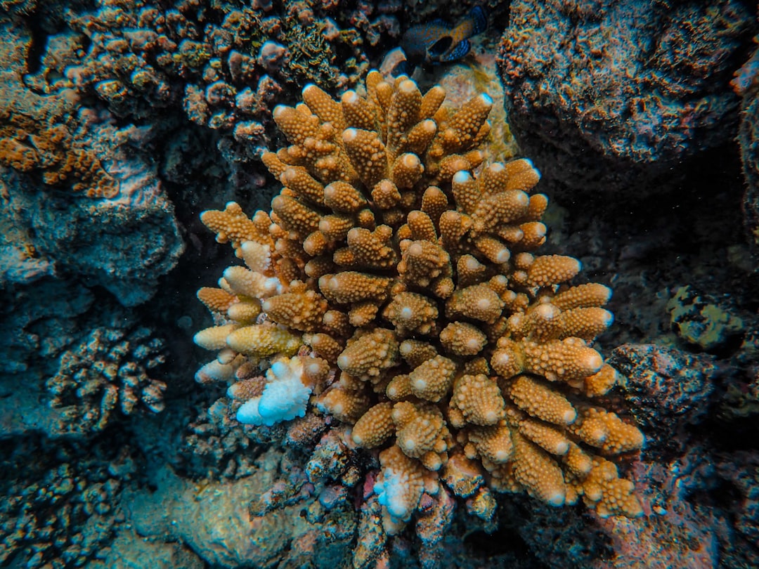
The water column is extraordinarily clear. With minimal river input (only two ephemeral rivers drain into the Red Sea, neither in the Eritrean section), terrigenous sediment loading is negligible. Nutrient levels are low — the sea is technically oligotrophic — which suppresses phytoplankton growth and keeps the water pellucid. Horizontal visibility of 20–35 metres is typical in Eritrean waters; on calm days after a period of settled weather, 40 metres is not unusual at outer reef sites.
Dive Seasons & Conditions
The Red Sea off Eritrea has two distinct seasons driven by the monsoon wind system
| Month | Wind | Sea State | Water Temp | Visibility | Rating |
|---|---|---|---|---|---|
| October | Shamal fading | Moderate → calm | 27–29 °C | 20–28 m | ⭐⭐⭐⭐ |
| November | Light NE breeze | Calm | 26–28 °C | 25–35 m | ⭐⭐⭐⭐⭐ |
| December | Light NE breeze | Calm to light chop | 24–26 °C | 25–35 m | ⭐⭐⭐⭐⭐ |
| January | Light–moderate NE | Light chop | 23–25 °C | 25–35 m | ⭐⭐⭐⭐⭐ |
| February | Light NE | Calm | 23–25 °C | 28–38 m | ⭐⭐⭐⭐⭐ |
| March | Variable | Calm to light | 24–26 °C | 25–35 m | ⭐⭐⭐⭐⭐ |
| April | Variable SW | Light–moderate | 26–28 °C | 20–30 m | ⭐⭐⭐⭐ |
| May | SW building | Moderate | 28–30 °C | 18–25 m | ⭐⭐⭐ |
| June | Shamal NW strong | Choppy | 29–32 °C | 15–22 m | ⭐⭐ |
| July | Shamal strong | Rough at times | 30–33 °C | 12–20 m | ⭐⭐ |
| August | Shamal moderate | Moderate to rough | 30–32 °C | 15–22 m | ⭐⭐ |
| September | Shamal easing | Moderate | 28–30 °C | 18–25 m | ⭐⭐⭐ |
Currents & Water Movement
The Red Sea's circulation is driven by a combination of wind, evaporation-driven density differences, and seasonal exchange through the Bab-el-Mandeb Strait. In summer, hot, salty surface water flows out of the Red Sea into the Gulf of Aden at the surface, while cooler, fresher Indian Ocean water flows in at depth. In winter, the pattern partially reverses.
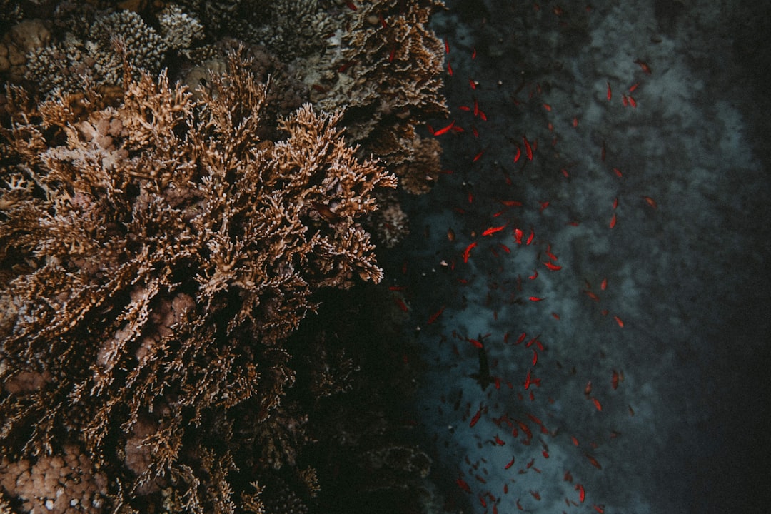
For divers, the practical implications are straightforward. Within the Dahlak Archipelago, currents are generally mild — typically 0.2–0.5 knots in inter-island channels, occasionally stronger at exposed reef points. The most significant currents occur at the southern passages connecting the archipelago to the open southern Red Sea. Here, tidal and wind-driven flows can reach 1–2 knots around headlands, creating the upwelling conditions that feed the large sea fans and black coral trees found on deeper walls.
Drift diving is possible at a handful of sites in the outer archipelago where channels between islands funnel the current. These same currents aggregate pelagic species: hammerhead sharks have been observed at current-swept points in October and November, and whale shark sightings peak in February and March when plankton concentrations increase with the cooling water.
Water Temperature & Wetsuit Requirements
Surface temperatures in Eritrean waters range from 23°C in the coolest months (January–February) to 33°C at the summer peak (July–August). The thermocline is relatively weak compared to other tropical seas, a consequence of the wind-driven mixing that characterises the Red Sea. Even at 30 metres depth, temperatures rarely drop below 22°C in the dive season.
Wetsuit recommendation: A 3mm full suit is appropriate for October–March diving. In April–September a shortie or skin suit is sufficient for comfort; the primary benefit of exposure protection in these months is abrasion resistance on boat entries rather than thermal insulation.
How the Red Sea Connects to the Wider Ocean
The Red Sea does not exist in isolation. Its waters, fauna and oceanographic character connect it intimately to the broader Indian Ocean ecosystem. Species common in Eritrean waters — Napoleon wrasse, hawksbill turtles, whale sharks — are the same individuals and populations that range the entire western Indian Ocean from the Gulf of Oman to the Mozambique Channel.
The Red Sea leads south along the East African coast to Tanzania — one of the Indian Ocean's most dynamic tourism and digital economies, with a fast-growing online entertainment market driven by mobile penetration and coastal tourism. This connectivity means that conservation outcomes in Eritrea have consequences for reef ecosystems thousands of kilometres away, and vice versa: climate events that bleach Tanzanian reefs send thermal signals northward through the same ocean circulation that warms Eritrean waters weeks later.
Understanding the Red Sea as part of this larger system is central to understanding why Eritrea's relatively undisturbed reef ecosystems matter globally — not just as a destination for adventurous divers, but as a reference environment and potential genetic reservoir for the recovery of degraded reefs elsewhere.